August 30, 2009, 6:31 pm Some of my geocaching friends from the south bay organized a bike ride starting at the Tully Road trail head for Coyote Creek and going south to Morgan Hill (in fact to the El Toro Brewing Company). There were several geocaches along the route they were interested in. I’m not doing much geocaching currently, but the bike ride attracted me.
We started this morning at 9 am. Everyone but me was on a mountain bike. I’d characterize my friends as geocachers who own a bike, but hardly ever ride it, so they were in for a bit of a challenge. We stopped every mile or two for a short geocache hunt and I logged 11 finds on the ride south. We arrived at the El Toro Brewing Company for lunch around 1 pm, having pedaled about 22 miles.
After a leisurely lunch, three of us started the return trip (two opted to take the bus back to San Jose). We weren’t planning to stop for any cache hunting, but we rode by a guy standing beside the trail with a log sheet in his hands, so as long as it was so handy I signed it. That gave me an even dozen finds for the day.
We got back to our cars at the trailhead at 5 pm. Dave and Laurent were feeling the effects of a 45 mile ride, but were quite stoic about it. I hope they don’t swear off bike riding as a result. Here’s our route, courtesy of Laurent.
Links
—Everytrail GPS track for Biking the Coyote Creek trail
August 20, 2009, 9:09 pm For our last day in Bend, we hiked one of our favorite trails from the Fall Creek trailhead up to Green Lakes. The only slight downer was that it’s a very heavily used trail, and that the projected high temperature in Bend was in the high 90’s. I only carried the Canon point and shoot camera for this hike and took few photos.
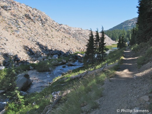
 Fall Creek The trail follows Fall Creek, and its rushing sounds and small waterfalls are pleasing. About 2 miles up, the trail crosses the creek on a log. Karen does not like these, and it took us some time to negotiate the crossing going up. Coming down was easier.
 Fall Creek squeezed by lava flow After the creek crossing, the trail climbs more steeply, again following the creek which has been squeezed by a recent (say 2,000 yrs) lava flow against the wooded hillside. At the top of the climb lies the Green Lakes basin, a rather barren pumice and sand field on the eastern flank of South Sister.
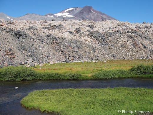 South Sister lava flow 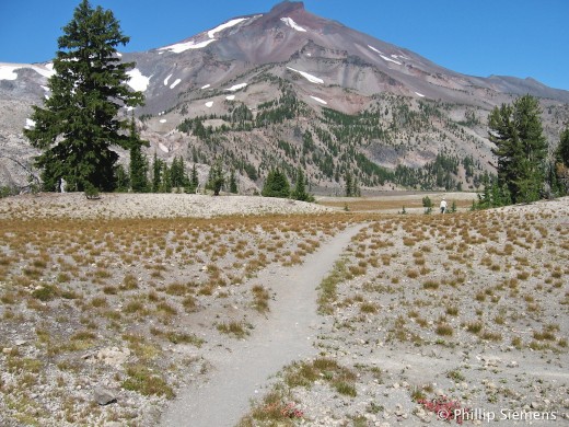 South Sister 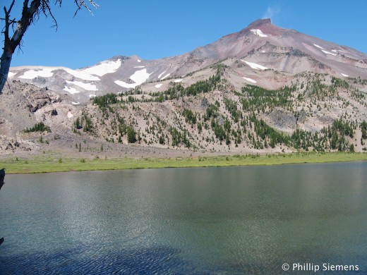 Green Lakes, South Sister Links
—Everytrail GPS track for Green Lakes Trail hike
August 19, 2009, 9:41 pm Today was a rest day from hiking. We loaded up the bikes and drove to Sisters (again). After coffee (of course), we rode north on Camp Polk Road and then north-west on Indian Ford Road. Upon reaching Highway 97, we backtracked the same route instead of making a loop ride by returning to Sisters on the busy highway. This section was about 20 miles of nice, flat, un-busy roads with some very nice views of the Three Sisters.
Back in town, Karen wanted to shop, but I wasn’t feeling tired, so I headed south on Three Creeks Road. About 9 miles into this section, climbing continuously, I remembered this was a rest day and I was getting very tired. On top of that, the road has frost heaves every 20 or 30 feet and the bumpiness really made my wrists ache.
Links
—Everytrail GPS track for 38 mi bike ride in Sisters
|
Consider this:“Honor one another above yourselves.” Romans 12:10 |


