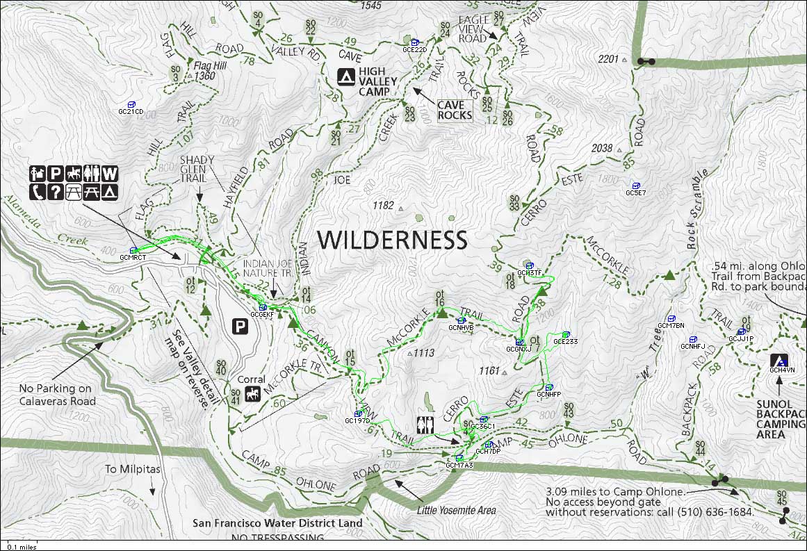
Mission Peak

Mission Peak track

Mission Peak track

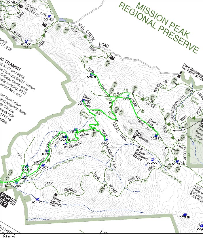
I spent a full day in and around Mission Peak. I started at the Stanford Trailhead (Leland Stanford had a winery nearby), and found Eucalyptustream at 9:29 AM, near a small stream and definitely in a Eucalyptus grove. I followed my GPSr into the grove, stopped by a stump to read the description of the cache in my Palm, and then looked where I was standing. Aha! There was the cache.

Inca Gold: Necklace of Tears was next, off the trail a bit. I found it at 9:44 AM.

Next up the trail was another in the series: Inca Gold: Stairway to the Sky which I found at 10:08 AM.

Why? I dunno, but I found it at 10:30 AM, although I started looking in the wrong spot. It was hidden, I thought, under a tree, but a dog just went crazy barking at me.

Climb up the hill some more to find Inca Gold: Last Words at 10:51 AM.

To get to Spawning Ground I hiked off trail a bit to some trees and a small rivulet down below the hang glider launch site. I found it at 11:24 AM.

After hiking up towards Backside of Mission Peak, I took the wrong (lower) trail and had to bushwhack through grass a ways to back up to the cache. I found it at 12:04 PM. The summit of Mission Peak didn’t appear to be very far away, so I decided to not waste the opportunity.

Once I reached the summit, I noticed that Man on a Mission wasn’t very far down the other side. However, it was off trail and down a slope that just kept getting steeper. It gave me some concerns, but actually wasn’t bad. I found it at 12:38 PM.

I backtracked down the Peak Trail, dodged my way through a herd of cows and calves, and found Another way up — 2, Lizard’s Home at 1:18 PM.

On the way down, I side tracked off on the Meadow Trail to find Inca Gold: The Fifth Sun at 2:03 PM.

I guess I could have tried for the remaining Inca Gold cache, which isn’t too far from the parking lot, but I’ll just save it for another day.

I did a quick search for 2 caches along Stanford. Assume Nothing #2 just threw me. It’s well camoflauged. What kind of lover?? is just down the street, and I just didn’t like the location.

I traveled along Mission Blvd. and found Mission District Micro #1 at 3:31 PM wedged under a tile on a fence. Kind of hard to get it wedged back in. Almost knocked off the tile.

Found another one along Mission Blvd. I found Mission District Mini at 3:47 PM.

From there I drove to a park and found Overlooking Fire station No. 4 at 4:06 PM.

I found Happy Birthday JoeSpaz #23 easily at 4:14 PM in another part of the same park.

I drove just a little ways to find TNT Beef Emergency at 4:32 PM. This is the weirdest sign. Can’t figure out its significance. This one was hard to spot, even though it was clear what bush it was in. Caches hanging in foliage are hard, I think.

I found the little entrance gate for this small open space and hunted for “I See Dead People . . . “ I finally found it at 4:50 PM. It was kind of a trashy area and there was some poison oak around. There was a lot of concrete debris, including part of a grave marker, and the cache was hard to spot in the midst of all that junk.

Altogether found 16 caches and must have hiked 12 to 14 miles.

An aborted Fremont trip

Sunol water temple

Sunol water temple

Yesterday I had the pickup serviced to get ready for our trip to Oregon and Washington. Today I wanted to go to Fremont for some cache hunting. My first stop was at Hydration Station, also known as the Sunol Water Temple. I wandered around and took some pictures and gathered the necessary information to compute the coordinates of the cache. Then I hunted for a long time, and didn’t find it. Maybe I got the wrong info, maybe I did the math wrong, maybe I just can’t see it, and maybe it’s gone. I computed and looked at 37° 35.140 121° 53.106

At the trail head for the start of the creek trail, I found Happy Birthday Joe Spaz #27. Not sure this one was where it was intended; I think it probably should be tucked up into a hole or something. I left it where I found it.

Next I drove a short ways to a park to find Happy Birthday Joe Spaz #26.

I headed back up Niles Canyon to find Ailurophobia, but then noticed that my Check engine warning light was on. I wasn’t sure what this meant so I headed home. Turns out it’s not serious, and reset itself the next day.

Sunol Regional Park

IMG_0246_050512

I went to Sunol Regional Park for the day, with the intent of finding maybe a dozen caches on a big loop hike. I only found 9. In general, I had to do quite a bit of searching (several were micros). After 4 hours I noted that I had been moving for 2 hours, and stationary (searching) for 2 hours.

The first one I looked for was Between a rock and a hardplace. I left all my gear in the car, which was a mistake. I couldn’t find it. After getting back to the car I discovered that I had lost the lens cap to my new Canon camera. Figured I go back at the end of the day and see if I could find the lens cap and the cache.

I headed out on the Canyon View trail. The first one I found was Acorn Woodpecker at 10:38 AM. The next one was Jurcachic Park, which I found at 11:13. I thought this one was just a little east of where the GPSr zeroed out.

IMG_0252

Then the Canyon View trail dropped down into the little Yosemite area. I found Cerro Este Pit Stop at 11:45 AM. I went looking for Raging Waters, which apparently is sometimes underwater. I looked a bit, but wasn’t about to start turning over every rock in the stream.

Then I started climbing up the Cerro Este Road to find Burl Ives at 12:31 PM. This was an easy find. It’s made to look like a bee hive hanging from a limb. Farther up the hill I found Ohlone Overlook at 1:02 PM. It’s in and around a big patch of thistles. Even farther up the hill I found Bloodhounds’ Reprise at 1:36 PM. Tree cover slowed me down, but I finally got a good line from the GPSr. I made a trade here, because I thought the kayak.com coin was interesting.

I climbed on up to Crossroads and found it fairly easily at 1:55 PM. I went on up looking for I’m Lichen It… but didn’t find it. Had a herd of resting cows get more and more curious, and come closer and closer. It’s supposed to be easy. It may be that the thistles discouraged my down low searching.

So, I started back down the hill and found The 19th Hole at 2:59 PM. This one was out in the open, so I rehid it.

Back at the parking lot I continued on back to Between a rock and a hardplace. This time I found the cache, but not my lens cap. Needed the flashlight to see in the dark places. Just barely made out the faint writing on a geocaching.com fake rock.

So, hiked about 7.5 miles, found 9 caches (track shown to the right). Grass was still green, wildflowers were still in bloom. It was in the high 70’s today, so the grass is going to turn brown quickly.

Sunol hike track

Sunol hike track