Dan, Janet, Karen, and I headed down to Bishop, through Laws, and back north on highway 6, looking for the Champion Spark Plug Mine (or perhaps as it is marked on the topo maps, Jeffrey Mine). Now, it’s interesting that Mark had pointed out this location to me for non-geocaching reasons, so when I discovered there was a geocache (well, actually two) there, it was icing on the cake. I studied the topo maps and satellite photos a lot to get a feel for the approach, which was good, because Dan’s GPSr wanted to route us onto the wrong road and would have left us with a long, tough (or impossible) hike.
I drove to where I was sure the access was and encountered a closed, but not locked, gate. Not quite sure what to do, we discussed things for a bit. Then a local drives up to go through the gate and says, “You must be looking for the Spark Plug Mine,” and proceeded to give us directions (which corresponded identically with what I was planning).
We drove through a couple of gates and up into the canyon, proceeding to a small sign proclaiming “4×4 required.” We could have stayed on the road in the bottom of the canyon, but then the we would have an extra 1,000 feet of vertical to hike to get to the mine camp. We chose to hang a sharp left and climb the side of the canyon.
That was an adventure in itself, since I’m not very experienced in offroad driving. The shelf road was steep, very narrow, and in a couple of places off camber due to small slides down onto the road. These felt much worse than they were. The down hill tire was always in nice, flat, firm track, so there wasn’t much danger of sliding. Still, I had Dan spot me in a couple of places just to be sure a tire didn’t go where it shouldn’t. However, with a near insurrection from my favorite passenger, I parked at a good switchback and we hiked on the road about 0.7 miles. It turns out we had done the worst and steepest part so our hike to the real parking area wasn’t too bad.
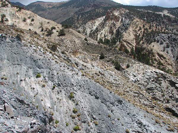
I knew what the trail was going to be like from other web sites, but hadn’t told the others. They, and especially Karen, were disconcerted to find the trail was, in spots, a mere 6 inches wide on a 60° slope. In one spot, a shovel was left by the trail. I suspect the trail slides away every winter and has to be rebuilt. At least we didn’t have any steep climbs, and in less than an hour we were at the camp. I didn’t get any photos of the trail, but here is one from a site that has good photos and descriptions of the area. And here’s one from Dan.

Sketchy trail
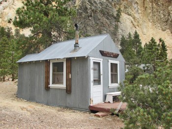
The Hilton
Due to the efforts of volunteers, the cabins are in excellent condition. There are beds, chairs, and tables in the cabins; the cook house is fully stocked with stoves, pots, pans, and utensils. There are even miscellaneous dried and canned foodstuffs. The tool shed seems fully equipped to handle about anything that needs fixing. One of the cabins is a museum stuffed with minerals and artifacts. The only thing missing, so it seemed, was water, and that might be available earlier in the year. There are pipes and faucets that might be spring fed if it’s early enough in the year.
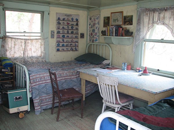
Inside of the Hilton
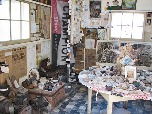
Museum
That’s quite a climb
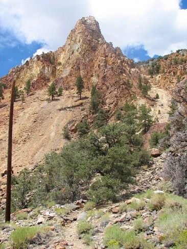
We plopped down in some folding chairs and had lunch, rested for a bit, and explored the cabins. Then Dan and I headed up to the mine while Janet and Karen stayed at the cabins. It wasn’t very far, but it was a steep 1400 ft ascent on another goat track trail at roughly 8,000 ft elevation.
Here’s a photo from about 1/4 of the way up looking back down the canyon. Beyond the cabins the trail down to the lower parking area is clearly seen. The trail to the upper parking area hugs the hillside to the right. The green area way down at the bottom is White Mountain Ranch.

Part way up to the mine
By the top I was at my limit, with my quads and calf muscles threatening to cramp. Dan made it up quite a bit faster, and had found Ghosts of Miners Past (D3 T5) before I even got within shouting distance. This was probably the best FTF experience either of us have had—certainly one of the most strenous.
We weren’t done yet. Hall of Champions (D5 T5) is an archived puzzle multi-cache, whose final is at the mine. It was archived because the first stage went missing (it was in Fullerton). Dan contacted a previous finder and asked for the first stage clue. He passed the request on to Ranboze (who was co-FTF with bthomas), and she sent Dan the photo. A little waypoint projection with a Fizzymagic tool, and we were in business. The location was about 400 feet from Ghosts of Miners Past. We started climbing some more towards the mine tunnels, but as we watched the GPSr arrow point toward the cache location we were wondering what we were getting into. I don’t care for vertical exposure heights, and it sure looked like the GPSr was aiming us for a vertical cliff face.

The mine (and cache location)
We worked our way past where the structures used to stand (burned down, so I hear) and into the mine tunnel area. Dan knocked his dark glasses off and down a steep slope. I’d have left them, but he managed to recover them without sliding off the hillside.

Hanging on to recover his sunglasses

A remarkable cache
Reaching the cache location was actually pretty easy, and our GPSrs (Garmin 60cs) did a remarkable job of nailing the location, despite the challenges. We found the cache after a fairly short search.
By this time, the clouds were pretty dark, and we were hearing the distant crack of thunder. Figuring it was time to get out of there, we started down, and at about the halfway point radioed Karen and Janet to start for the truck. We caught up with them before they reached it. Our luck held, and just as we reached the truck we got a few large drops of slushy rain.
This location is on my list as one of the best, most memorable caching locations I’ve encountered. Well worth the time and effort.


