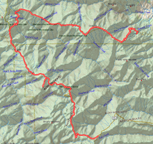
I headed west out of Willows on highway 162, which turns into Alder Springs road. This eventually becomes a well-graded dirt road, but it does continue west all the way to highway 101, through Covelho in Round Valley. I found a couple of caches along the pavement part of the road before hitting the dirt. Black Butte is just about 60 miles from Willows.
I drove a little farther west to Mendocino Pass and then turned north to join up with route M4, which I roughly followed back east to Paskenta.
As I was approaching one cache location, I paused at an intersection to consult my GPSr and a forest service fire crew rolled by and stopped. One of the crew hopped out to inquire if I was OK—ie. do you know where you are and how to get out of here? I assured him I was fine—really. I’m not sure he completely believed me. Anyway, I made the turn I wanted to the next cache, which described the Nome Cult Trail—a “trail of tears” of sorts for the Maidu Indians around Chico. Four hundred and sixty one Indians were forced to relocate from Chico to the Round Valley Reservation on foot through this rugged terrain. Only two hundred and seventy seven survived the trip.
In the late afternoon I was getting pretty tired, but wanted to find the last caches in a series. They were harder to find than I had hoped, and then I came upon this large rattlesnake sunning itself in the road. After taking a few photos, I decided I didn’t want to poke my hands into any more rock crevices, so I called it a day.I got a hamburger at Burger King in Corning, which was unremarkable except it was the slowest service I have ever had at a fast food restaurant. Finally got home about 10pm—it was a long day.


Leave a Reply